
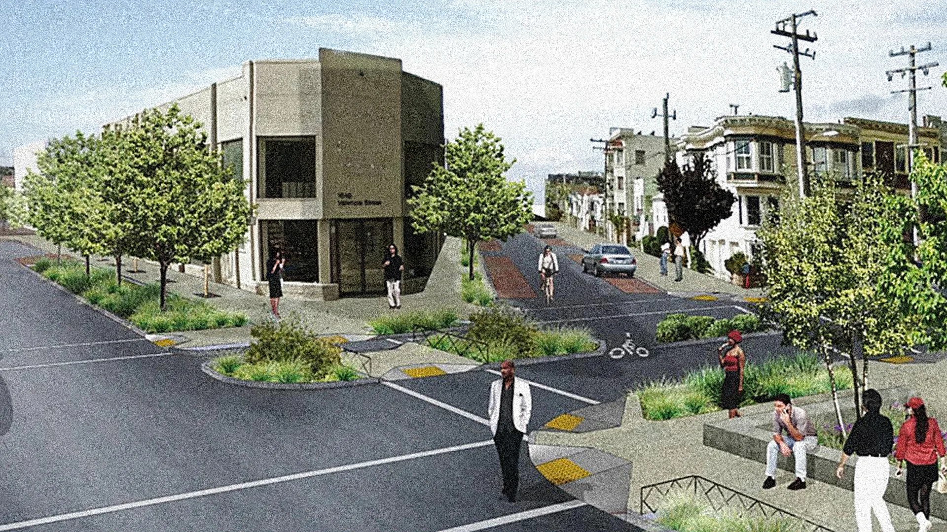

Bike Lanes in Canarsie work best as a connected neighborhood network rather than one continuous protected corridor. The strongest links run around Canarsie-Rockaway Parkway, Rockaway Parkway, Seaview Avenue, Canarsie Park, Shore Parkway, and the Jamaica Bay Greenway. The main catch is simple: protection and comfort change from block to block.
The route notes below are based on NYC DOT, DDC, MTA, and other official city material rather than made-up firsthand stories. The useful question here is whether a rider can move cleanly between a bicycle route, the L train, buses, neighborhood streets, parks, and the Jamaica Bay waterfront.
| # | Connection | Closest useful transit | Rough cost | Best for |
|---|---|---|---|---|
| 1 | Canarsie-Rockaway Parkway Station | L train and connecting buses | Bike connection free; transit fare separate | Bike-to-subway trips |
| 2 | Rockaway Parkway Corridor | L at the north end; B42 along the corridor | Free to ride | North-south neighborhood movement |
| 3 | Shore Parkway Canarsie Pier Connector | B42 toward Canarsie Pier | Free | Waterfront access |
| 4 | Seaview Avenue and East 102nd Street | Rockaway Parkway bus connection nearby | Free | Reaching Canarsie Park |
| 5 | Canarsie Park Connection | Local bus connections around Seaview Avenue | Free | Families and recreational riders |
| 6 | Paerdegat Avenue North Connector | Flatlands Avenue bus connections | Free | Flatlands-to-waterfront riding |
| 7 | Jamaica Bay Greenway Westbound | Transit varies by segment | Free | Longer recreational rides |
| 8 | Jamaica Bay Greenway Eastbound | Canarsie Pier and eastern Brooklyn connections | Free | Longer rides toward Queens |
Bike Lanes in Canarsie Around the L and Rockaway Parkway
The northern end of the neighborhood matters because this is where bicycle travel starts working as part of a larger transit trip. The official NYC Bike Map distinguishes protected lanes, conventional lanes, shared routes, and greenways, which is important in Canarsie because the riding environment is not identical from one street to the next. DOT also warns that the web map is updated periodically rather than in real time.
1. Canarsie-Rockaway Parkway Station
Bike Lanes in Canarsie become more useful when you treat Canarsie-Rockaway Parkway as the neighborhood’s main bike-to-transit handoff rather than merely the last L stop. A rider coming from farther south can head toward the station, lock up where permitted, or continue the trip by transit when weather, distance, or time makes riding the whole way unattractive.
Accessibility is better here than people working from an old mental map may expect. The MTA completed an ADA-compliant ramp and other accessibility work at the station complex in 2020, including improvements to the adjoining bus facility. The MTA’s Canarsie-Rockaway Parkway accessibility update is worth checking if step-free access is part of the trip.
The catch is the transfer itself. A subway terminal surrounded by buses, turning vehicles, pedestrians, and delivery activity is not the place to drift through on autopilot. Slow down before the station area and decide whether you’re ending the bike portion or continuing south.
For a stroller, wheelchair, or mobility device, confirm current station conditions before leaving home even when a station is designated accessible. For cyclists, weekend L changes are another reason to check service rather than assuming the trip home will mirror the trip out.
2. Rockaway Parkway Corridor
Rockaway Parkway is the neighborhood’s clearest north-south spine because it links the L terminal area with streets farther south and continues toward the waterfront. The B42 also runs along Rockaway Parkway between the subway station and the Canarsie Pier end of the corridor, making this one of the more understandable bike-bus relationships in the neighborhood.
That doesn’t mean every block should be treated as a protected bicycle facility. This is the mistake visitors make when they see one useful bike segment on a map and assume the same street experience continues uninterrupted. Canarsie’s network mixes facilities and street conditions, so intersections deserve more attention than the colored line on a map might suggest.
Rockaway Parkway is strongest for practical neighborhood trips: getting from residential blocks toward the L, reaching shops around the main avenue crossings, or working south toward Seaview Avenue and Jamaica Bay.
At weekday commuter times, expect more turning movements and transit activity near the station. On a summer weekend, the pressure shifts south as more people head toward the waterfront. Same corridor, different friction.
Where Neighbors Transfer With Ease Toward the Waterfront
The southern half of the trip is where the network starts feeling less like a basic neighborhood bike route and more like an access system for Jamaica Bay. City projects have specifically worked on filling connections around Canarsie Pier and linking existing neighborhood routes with the greenway.
3. Shore Parkway Canarsie Pier Connector
Bike Lanes in Canarsie make their biggest jump in usefulness near Shore Parkway. The Canarsie Pier Connector filled a missing piece around the pier approach, where riders once had to negotiate the Belt Parkway exit area and traffic circle with less separation.
The city completed a grade-separated, two-way bicycle connection around Rockaway Parkway and Shore Parkway in 2023. The project also added or upgraded pedestrian ramps, sidewalks, curbs, drainage work, and other street elements. The city’s Canarsie Pier Connector project summary describes it as a direct link between the existing bike network, Canarsie Pier, and the Jamaica Bay Greenway.
This is one of the locations where seeing the design on the ground makes the network easier to understand. The raised two-way section is visually different from an ordinary painted lane.
The honest drawback comes at the transitions. A protected piece can make riders relax too early. Belt Parkway ramps, turning traffic, and the pier approach still require attention wherever the separated facility meets road traffic.
Summer afternoons can bring more waterfront traffic. Cold, windy winter days are the opposite: fewer recreational riders, but Jamaica Bay exposure can make the ride feel harsher than an inland trip of similar length.
4. Seaview Avenue and East 102nd Street
Seaview Avenue and East 102nd Street form another useful piece of the connection between Canarsie Park and the pier side of the neighborhood. NYC DOT’s earlier Jamaica Bay Greenway access work extended the route using Rockaway Parkway, Shore Parkway, East 102nd Street, and Seaview Avenue.
For a rider coming from the park side, this matters because the trip doesn’t require treating every major east-west road as the obvious choice. The route can instead work through the streets that were specifically incorporated into the Canarsie Pier access project.
This section is more useful for local access than speed. Watch driveways, parked vehicles, turning movements, and crossings where markings change. If you’re riding with a child, this is also where route planning matters more than simply picking the shortest line on your phone.
The thing people get wrong is thinking “greenway access” means a park-style path from the moment they leave home. It doesn’t. In Canarsie, the useful network includes park paths, separated pieces, painted lanes, and ordinary street transitions.
For problems the route guide can’t solve, use the official channels. Call 911 for an immediate emergency. For potholes, faded markings, debris, construction obstructions, or other maintenance problems affecting a bike lane, NYC residents can use the NYC311 bike-lane reporting guidance; transit problems belong with the MTA rather than DOT.
Bike Lanes in Canarsie Around Parks and Paerdegat Basin
The western side of the local network matters for a different reason. It gives riders access to Canarsie Park and the Paerdegat Basin side of Jamaica Bay rather than funneling every trip through Rockaway Parkway. Paerdegat Basin sits between Flatlands and Canarsie, with parkland around its southern end.
5. Canarsie Park Connection
Bike Lanes in Canarsie aren’t only about commuting to the L. Canarsie Park is where the system becomes useful for someone who wants a local recreational ride, a family outing, or a quieter starting point before moving toward Jamaica Bay.
The park-side connection works with the Seaview Avenue network and the routes around Paerdegat Basin. DOT’s past project records show the Canarsie Park and Jamaica Bay work was designed to link the park area with the wider waterfront bicycle network.
This is the better side of the neighborhood for riders who care more about continuity and open space than reaching a subway entrance quickly. It also gives you an easy bailout: a recreational ride can stay local instead of becoming a long greenway loop.
Families should still separate “park riding” from “street riding” in their planning. A comfortable path inside or beside parkland doesn’t guarantee the next street crossing will feel equally calm.
Late spring and early fall are hard to beat here. Summer gives you long daylight but more heat and waterfront traffic. In winter, the practical limit is often daylight and wind rather than mileage.
6. Paerdegat Avenue North Connector
Paerdegat Avenue North is the western connector people overlook when they think the Canarsie bicycle network begins and ends at Rockaway Parkway. City planning identified a two-way recreational multi-use route along the east side of Paerdegat Basin from the Flatlands Avenue area toward Seaview Avenue, tying into Canarsie Park.
That makes this side useful for someone arriving from Flatlands or approaching Canarsie from the northwest. Instead of pushing east first and then doubling back toward the waterfront, the Paerdegat connection can bring you toward parkland and Jamaica Bay more directly.
The geography also explains why this feels different from central Canarsie. Paerdegat Basin forms a real physical edge, not merely another named street. DEP places the basin between Flatlands and Canarsie, running southeast toward Jamaica Bay beneath the Belt Parkway area.
Don’t expect a Midtown-style grid where missing one turn costs thirty seconds. Around basin edges and parkland, a wrong turn can push you onto a less useful street and make the correction annoying. Check the route before moving south of Flatlands Avenue.
Longer Greenway Connections Beyond Canarsie
This is where Bike Lanes in Canarsie stop being only neighborhood infrastructure. Once a rider reaches the Jamaica Bay system, Canarsie becomes a launch point for trips that connect waterfront parks and communities well beyond the neighborhood itself.
7. Jamaica Bay Greenway Westbound
Bike Lanes in Canarsie feed into one of southern Brooklyn’s most useful recreational cycling systems. NYC DOT describes the Jamaica Bay Greenway as a network linking waterfront communities with destinations including Canarsie Pier, Marine Park, Floyd Bennett Field, Rockaway Beach, and the Jamaica Bay Wildlife Refuge. The NYC DOT greenways overview also notes continuing upgrades around Paerdegat Avenue in Canarsie.
Heading west makes sense for a rider who wants the outing to grow beyond a short Canarsie loop. Canarsie Park and the basin-side connections become feeders instead of destinations.
This is also where you should stop judging distance the Manhattan way. A waterfront ride can be pleasant enough that you keep going, then discover the return leg feels much longer into wind or late-day heat. Decide your turnaround point before fatigue decides it for you.
For older riders, children, or anyone using an adaptive cycle, the important question is not only distance. Check surface conditions, street-transition points, daylight, weather, and a realistic place to turn back.
8. Jamaica Bay Greenway Eastbound
The eastern side works differently. From the Canarsie Pier area, the larger Jamaica Bay network points toward Spring Creek and eventually the Queens side of the bay as the greenway system develops and connects existing segments. DOT says existing sections already serve communities from Sheepshead Bay and Spring Creek through Howard Beach and the Rockaway Peninsula, while other gaps and upgrades remain part of ongoing work.
That’s why this shouldn’t be approached as one perfectly uninterrupted protected trail. Plan each longer ride around the current map, not around the idea of a completed loop.
The payoff is range. A neighborhood rider can start near the L, work down Rockaway Parkway, pass through the pier connector, and turn a short local trip into a Jamaica Bay ride without first transporting the bicycle across Brooklyn by car.
But longer isn’t automatically better. If the weather is unstable, daylight is fading, or you’re uncertain about a gap farther ahead, turning around at Canarsie Pier can be the smarter ride.
How to Use Bike Lanes in Canarsie Without a Car
A simple trip pattern works well: choose your nearest safe connection, identify the point where you join the established bike network, and decide before leaving whether the L station or Jamaica Bay is your anchor. Don’t improvise the entire route one intersection at a time.
For a bike-to-subway trip, Canarsie-Rockaway Parkway is the obvious transfer point. For a waterfront trip, Rockaway Parkway and the Shore Parkway connector are more useful. For a park-first ride, the Seaview Avenue, Canarsie Park, and Paerdegat side deserves a look before you automatically ride toward the station.
Where Neighbors Transfer With Ease is less about finding one perfect lane and more about choosing the right handoff. Subway, bus, park path, neighborhood lane, and greenway each solve a different part of the trip.
Check weather before a longer Jamaica Bay ride. Wind matters more beside open water than it does several blocks inland. In July, carry enough water and plan for heat. In January, shorter daylight makes a late-afternoon turnaround more important.
And check the bike map again if you haven’t ridden the route in a while. DOT says its network map is updated periodically, while construction and street conditions can change sooner than the map does.
What Bike Lanes in Canarsie Still Get Wrong
The biggest weakness is inconsistency. Bike Lanes in Canarsie can move you between several strong pieces, but a useful protected or separated section doesn’t guarantee the next block delivers the same comfort.
The Canarsie Pier Connector is a good example of both progress and the remaining problem. The city filled a recognized missing link around the pier and Belt Parkway approach, yet riders still have to understand where protected design ends and normal intersection judgment takes over.
Skip the “shortest route wins” habit. A phone may choose a direct avenue because the distance looks good while ignoring the reason a slightly longer park or greenway connection feels better on a bicycle.
The other bad assumption is that every rider wants the same network. A confident commuter trying to catch the L has different priorities from a parent riding with a child. Someone on an adaptive cycle may care most about curb transitions and path width. A recreational rider headed toward Jamaica Bay may accept extra distance to avoid a stressful intersection.
Canarsie works better by bicycle when you plan for those differences instead of pretending the neighborhood has one universal cycling route.
Frequently Asked Questions
Are Bike Lanes in Canarsie fully protected?
No. The Canarsie network contains different types of bicycle facilities and connecting streets rather than one continuous protected lane. Some segments, such as the newer Canarsie Pier connection, offer stronger separation. Check the current DOT bike map before assuming protection continues through an entire trip.
Can I bike from the L train to Canarsie Pier?
Yes, the Rockaway Parkway side of the neighborhood provides the main north-south connection toward Canarsie Pier. The B42 follows the same broad station-to-pier corridor, while bicycle infrastructure connects toward Shore Parkway and the Jamaica Bay Greenway near the waterfront.
Is Canarsie-Rockaway Parkway accessible?
The MTA completed an ADA-compliant ramp and related accessibility improvements at Canarsie-Rockaway Parkway in 2020. Riders who need step-free access should still check current MTA accessibility and service conditions before traveling because temporary outages or construction can affect a trip.
Where Neighbors Transfer With Ease from bikes to transit in Canarsie?
Canarsie-Rockaway Parkway is the clearest bike-to-subway transfer point because it is the L terminal and an intermodal bus location. Rockaway Parkway also links the station area with streets leading south toward Seaview Avenue and the Canarsie Pier side of the neighborhood.
Can I reach the Jamaica Bay Greenway from Canarsie?
Yes. City transportation projects specifically connect Canarsie and Canarsie Pier with the Jamaica Bay Greenway. The greenway links waterfront areas and parks around Jamaica Bay, although riders should not assume every segment of the larger planned system offers the same facility type or level of separation.
Is Canarsie Park useful for beginner cyclists?
It can be a more manageable destination than committing immediately to a long Jamaica Bay ride. The park-side network connects with Seaview Avenue and Paerdegat Basin routes, giving riders options for shorter trips. Beginners should still review the street crossings required to reach the park from home.
Are Bike Lanes in Canarsie good for families?
They can support family rides, especially around Canarsie Park and waterfront connections, but route choice matters. Don’t assume a comfortable park section means every connecting street is equally comfortable for children. Review crossings and facility types beforehand, and shorten the route if conditions change.
What is the best time to bike around Canarsie?
Spring and fall often make longer waterfront rides easier because extreme heat and short winter daylight are less of a factor. Summer offers more daylight but can bring heat and busier waterfront activity. Whatever the season, check weather, daylight, transit service, and the current bike map before a long ride.
The best way to understand Bike Lanes in Canarsie is to stop looking for one perfect lane and start looking at the handoffs. The L terminal handles the transit side, Rockaway Parkway carries the neighborhood connection, and Canarsie Park, Shore Parkway, and Jamaica Bay open the trip outward. Before your next ride, pull up the current NYC bike map and trace your exact connection from home to the first protected or greenway segment.
This is general local information. Street layouts, transit service, construction conditions, and schedules can change, so confirm current conditions with NYC DOT, NYC311, or the MTA before traveling; questions involving your health or another professional matter belong with a qualified professional.
Latest New York Local Reports
Neighborhood guides covering transportation, housing, jobs, food, attractions and local events across New York.