
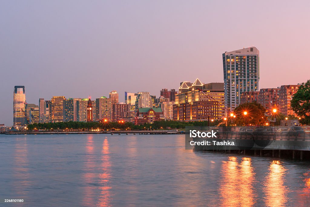

The best waterfront views in Eltingville start at Crescent Beach Park, then spread east toward Great Kills and west along Raritan Bay. Crescent Beach is the closest easy choice for a quick family photo stop; Great Kills gives more open water; Mount Loretto delivers a wilder shoreline; and Fort Wadsworth is worth the longer trip when the bridge and harbor matter more than proximity.
The practical focus here is local: how much effort the shoreline requires, whether a stroller makes sense, and whether the view actually rewards the trip. One thing to know before setting out is that “skyline” on the South Shore often means distant city shapes, the Verrazzano-Narrows Bridge, harbor traffic, or the New Jersey shoreline rather than a postcard-size Lower Manhattan skyline.
| Waterfront spot | Area and useful transit | Rough 2026 cost | Best for |
|---|---|---|---|
| Crescent Beach Park | Eltingville/Great Kills; Eltingville or Great Kills SIR plus onward walk/bus | Free | Closest family shoreline |
| Great Kills Park | Great Kills; S78/S79 to Hylan Boulevard entrance | Free; some restricted parking areas | Harbor panoramas |
| Wolfe’s Pond Park | Prince’s Bay/Huguenot; South Shore SIR plus bus/walk | Free | Beach plus playground day |
| Lemon Creek Park | Prince’s Bay; Prince’s Bay SIR plus walk/bus | Free | Marina and quiet water photos |
| Mount Loretto Unique Area | Prince’s Bay; SIR plus bus/walk | Free | Natural coastal scenery |
| Conference House Park | Tottenville; Tottenville SIR or S78 | Free | Sunset and Raritan Bay |
| Cedar Grove Beach | New Dorp Beach; New Dorp SIR plus local bus | Free | Verrazzano views |
| Fort Wadsworth Overlook | Fort Wadsworth; S51 from St. George | Free | Biggest harbor-and-bridge payoff |
The Closest Waterfront Views in Eltingville
For families who do not want a half-day expedition, the strongest waterfront views near Eltingville are clustered around Crescent Beach and Great Kills. Both put open water within practical reach of the neighborhood, but they feel different once you arrive: Crescent Beach is quieter and more natural, while Great Kills has the scale of a destination park.
1. Crescent Beach Park
Crescent Beach Park is the obvious first stop for waterfront views in Eltingville because it sits along the shoreline between Tennyson Drive and Raritan Bay, close enough that this can be an after-dinner outing rather than a planned excursion. NYC Parks specifically describes the beach as having views across Great Kills Harbor and Raritan Bay, with the skyline and Verrazzano visible from the shoreline. The NYC Parks guide to Crescent Beach is worth checking before a visit.
The best photographs usually come from moving toward the open beach rather than staying near the inland recreation areas. On a clear late-afternoon day, boats, distant structures, broad sky, and the curve of the bay give phone cameras more to work with than the skyline alone. May and June also bring horseshoe crabs onto portions of the shoreline, another reason families should watch where children step near the water.
There is a catch. This is not Brooklyn Bridge Park with skyscrapers filling half the frame. The distant skyline can be subtle, especially in haze, so come for the coastal scene first. Sunset light and a clear horizon make a bigger difference here than expensive camera gear.
2. Great Kills Park
Great Kills Park gives Eltingville families more room to turn a waterfront outing into several hours outside. The National Park Service describes the 523-acre South Shore park as having beach facilities, trails, fishing areas, a marina, boat access, and a multi-use path. Its open scale makes it one of the better Eltingville waterfront-view options when you want boats and horizon in the same photograph.
For families without a car, the important detail is that the park entrance is served from Hylan Boulevard by the S78 and S79, according to the National Park Service Great Kills guide. Great Kills SIR station is also on the MTA’s accessible-station list, although the waterfront itself remains farther away than the railway platform. That last stretch is what visitors tend to underestimate.
Late afternoon works particularly well because the shoreline loses some of its midday glare. Summer weekends naturally bring more beach traffic; cool spring and fall days are easier when the goal is walking and photography rather than swimming. Crooke’s Point has separate permit rules for vehicle parking, so do not assume every road or parking area inside the broader park works like an ordinary neighborhood lot.
If access, closures, beach conditions, or transportation details have changed, use the official agency rather than relying on an old neighborhood post. NYC 311 can handle city-service questions, NYC Parks covers city park facilities, and the National Park Service handles Great Kills and Fort Wadsworth. For anyone using a wheelchair, walker, or stroller, the MTA’s accessible-station list is the sensible transit check before leaving home; Great Kills, New Dorp, St. George, Arthur Kill, Dongan Hills, and Tottenville are currently listed as accessible SIR stations.
South Shore Waterfront Stops for a Longer Family Walk
Heading southwest changes the character of the waterfront views near Eltingville. The shore becomes less about a distant urban profile and more about beaches, wetlands, marinas, birds, and Raritan Bay. For children who get bored standing around while adults photograph a horizon, these stops offer more reasons to stay.
3. Wolfe’s Pond Park
Wolfe’s Pond Park is one of the better compromises between a traditional family park and a coastal photo location. NYC Parks describes it as a beach, wildlife preserve, and recreation area, with Raritan Bay forming its southern edge. That mix matters when you have children who want playground or picnic time while somebody else wants twenty minutes beside the water.
The shoreline itself feels more open and less built-up than the waterfront closer to the Verrazzano. Photos tend to be about the bay, weather, waves, shorebirds, and distant land rather than Manhattan towers. That is not a weakness. On cold clear days, the lower winter sun can make this stretch more visually interesting than a hazy July afternoon.
Getting here without a car is the weak point. South Shore rail stations do not drop you at the beach, and the last portion generally requires a bus or a substantial walk. Families carrying folding chairs, beach bags, or toddler equipment will notice that difference. If ease matters more than scenery, Crescent Beach wins.
4. Lemon Creek Park
Lemon Creek Park shifts the photograph again. Instead of an exposed beach dominating the frame, you get Prince’s Bay, marina activity, marshland, fishing areas, and the meeting of creek and coastal water. NYC Parks identifies the site as a waterfront facility with fishing, trails, natural areas, a marina, playground space, and kayak or canoe access.
This is a good stop for families who photograph people rather than landscapes. A child walking along the waterfront with boats behind them often makes a stronger South Shore picture than trying to force a barely visible skyline into the background. Early evening is calmer visually because harsh reflections off the water begin to soften.
Prince’s Bay SIR gets you into the general area, but it is not one of the SIR stations currently appearing on the MTA’s accessible-station list. Anyone using a wheelchair or pushing a heavy stroller should plan the final connection rather than assuming railway proximity equals easy waterfront access.
Wild Shoreline Views West of Eltingville
For a quieter version of waterfront views in Eltingville, continue west toward Mount Loretto and Tottenville. These trips take longer, but the payoff is less pavement, broader coastal space, and fewer reasons to rush.
5. Mount Loretto Unique Area
Mount Loretto Unique Area is where the South Shore starts feeling far removed from the rest of New York City. The state-managed property contains more than 200 acres of forest, grassland, wetlands, and coastal shoreline, including roughly a mile of sand-and-cobble coast facing Prince’s Bay. Its Beach Loop and other trails make it an actual walk rather than a pull-over-and-take-a-picture stop.
The DEC guide to Mount Loretto lists it as free and open year-round from dawn to dusk. DEC also identifies accessible features at the property, making this one of the more useful places to investigate if someone in the family has mobility needs.
Photographically, the attraction is scale. Put a person low in the frame, leave room for the bay and sky, and the shot immediately reads differently from a neighborhood park picture. Migrating birds can add movement during the right seasons. The downside is exposure: wind off the bay is no joke in late fall or winter, and there is less shelter once you commit to the coastal section.
6. Conference House Park
Conference House Park sits at the southern end of Staten Island and rewards families willing to travel farther from Eltingville. NYC Parks describes the roughly 265-acre property as combining historic buildings with expansive Raritan Bay views. It is a better sunset destination than a Manhattan-skyline destination, and that distinction prevents disappointment.
Transit is unusually clear for a far-South-Shore park. Tottenville SIR and the S78 are established approaches, and Tottenville station appears on the accessible SIR list with ramp access. The official Conference House Park page should be your check for park information before making the trip.
Come late enough for warm light but not so late that you are negotiating unfamiliar trails after dark. In summer, sunset visits can feel like a small trip out of the city. In February, the same shoreline is much more about wind, empty space, and ten good minutes outside before everyone wants the heater.
Go Northeast When the Skyline Matters More Than Distance
If “skyline” really means a large bridge, the Lower Harbor, and stronger visual evidence that you are still in New York City, drive or ride northeast. These are not the closest waterfront views in Eltingville, but they produce more immediately recognizable Staten Island photographs.
7. Cedar Grove Beach
Cedar Grove Beach is a useful middle ground. NYC Parks includes it among Staten Island shoreline locations with views toward the Verrazzano-Narrows Bridge, and the park system’s hiking information also notes a bridge view from the beach area.
For a family photo, the trick is not to zoom too aggressively. Let the bridge sit in the background while keeping beach, water, and people in the foreground. That gives the picture depth and makes modest phone-camera zoom far less of a problem.
New Dorp SIR is useful for reaching this side of Staten Island and is currently an accessible station with elevators and connections to several local buses. It still does not place you directly on the sand, so families with small children should factor the last leg into the outing.
Summer brings the obvious beach appeal, but a dry October afternoon can be better for photographs because the light is softer and there is less pressure to make the outing about swimming. If the only goal is a quiet beach near home, though, going this far from Eltingville makes little sense.
8. Fort Wadsworth Overlook
Fort Wadsworth Overlook is the choice for families who care more about the photograph than staying close to Eltingville. The National Park Service describes Fort Wadsworth as a 226-acre waterfront site on the Narrows with broad New York Harbor views, walking and biking opportunities, and a dedicated overlook. It sits directly beside the Verrazzano-Narrows Bridge, so the structure dominates photographs in a way it never will from the South Shore.
From St. George, NPS directs visitors to the S51 bus. For somebody starting in Eltingville, that can create a much longer public-transit outing than the distance on a map suggests. This is Staten Island in miniature: miles tell you less than transfers do.
The overlook is particularly good when skies are clear after a weather front, when haze has dropped and the harbor looks sharper. Children also have an actual fort landscape to look at instead of being asked to admire a distant horizon. Skip it for a twenty-minute spontaneous sunset run; save it for the day when the destination itself is part of the plan.
How to Reach These Waterfront Views Without a Car
The Staten Island Railway helps, but it does not hug the South Shore waterfront. That is the planning mistake visitors make most often. A station may look close on a small phone map while still leaving a long walk, a bus connection, or an awkward stretch with children and gear. The railway itself runs between St. George and Tottenville around the clock, while service patterns and weekend work can change.
For Crescent Beach and Great Kills, start by comparing Great Kills SIR with the Hylan Boulevard bus corridor. Great Kills is currently step-free, which can make it a better transfer point for a stroller or wheelchair even when another station looks marginally closer.
For the southwest shoreline, Tottenville is the strongest accessible rail endpoint, while Prince’s Bay and Huguenot are not currently listed among accessible SIR stations. Mount Loretto and Lemon Creek therefore deserve extra route planning for anyone who cannot comfortably use stairs or walk a long final stretch.
And always check weekend service before leaving. The MTA has repeatedly scheduled weekend work affecting the Staten Island Railway, including service interruptions during 2026. A trip that looks simple on Friday afternoon can require a different connection on Saturday.
What Is Not Worth Chasing Here
Do not drive around Eltingville hunting for a secret overlook where Lower Manhattan suddenly fills the horizon. That is the wrong expectation for this part of Staten Island. Crescent Beach can provide distant skyline elements, but its real strength is the combination of Raritan Bay, Great Kills Harbor, boats, shore, sky, and the Verrazzano in the distance.
The other mistake is assuming every waterfront equals a swimming beach. These locations include nature areas, marshes, fishing shoreline, trails, and federally managed land, each with different rules and seasonal conditions. Great Kills also has special parking restrictions around Crooke’s Point, so a social-media “hack” telling you to drive straight to the tip can turn into a wasted trip without the proper permit.
Families with toddlers should also resist packing three or four waterfronts into one afternoon. Staten Island travel time accumulates quickly once buses, parking, bathroom stops, and shoreline walks enter the equation. Pick one close stop and one destination stop. You’ll get better photos and fewer tired faces.
Frequently Asked Questions
Where is the closest waterfront view to Eltingville?
Crescent Beach Park is the strongest first choice because its shoreline sits directly beside the Eltingville/Great Kills area. It offers Raritan Bay and Great Kills Harbor scenery, and NYC Parks specifically notes distant skyline and Verrazzano views from the beach.
Can you see the Manhattan skyline from Eltingville?
You can get distant skyline elements from parts of the nearby shoreline, but do not expect the large Lower Manhattan view seen from Brooklyn or Jersey City. Clear air matters. Crescent Beach is officially noted for skyline views, while northeastern Staten Island locations provide stronger harbor perspectives.
What is the best Eltingville waterfront spot for sunset photos?
Crescent Beach is the easiest nearby option, while Conference House Park and Mount Loretto are stronger choices when you are willing to travel farther west. Their Raritan Bay setting gives sunset photography more open sky and water, especially on clear evenings.
Which waterfront park near Eltingville is best for children?
Wolfe’s Pond Park works well when the outing needs more than photographs because NYC Parks combines shoreline with recreation and playground opportunities. Great Kills is another strong choice for families wanting longer walks, beach space, and a broader park landscape.
Which Staten Island waterfront view has the best Verrazzano photos?
Fort Wadsworth gives the strongest close-up setting because it sits beside the Narrows and has a dedicated harbor overlook. Cedar Grove Beach offers a more distant beach-and-bridge composition, which can work better when you want family members in the foreground.
Can I reach these Eltingville waterfront views by train?
Yes, but the Staten Island Railway rarely finishes the trip by itself. Great Kills, New Dorp, and Tottenville are useful accessible stations for several locations on this list, while buses or walking usually handle the final stretch toward the shoreline.
Are these Staten Island waterfront parks free?
The parks and natural areas listed here generally do not charge ordinary admission, but special activities, permits, and particular parking areas can have separate rules. Mount Loretto is explicitly listed by DEC as free, while Crooke’s Point requires a permit for vehicle parking.
What time is best for photographing waterfront views near Eltingville?
Late afternoon through sunset usually gives families the easiest light because the water is less harsh than around midday and the sky becomes part of the photograph. For distant skyline details, prioritize a clear, low-haze day; weather visibility matters more than simply arriving at a particular hour.
Waterfront views in Eltingville work best when you stop expecting a Manhattan postcard and start using the South Shore for what it actually gives you: big water, long horizons, boats, bridges, beaches, and room for the family to stay in the frame. Crescent Beach is the easy neighborhood choice; the farther shoreline stops are for days when the outing matters as much as the photograph. Before heading out this weekend, check MTA service and the managing park agency’s current conditions.
This is general local information; schedules, access rules, permits, and park conditions can change, and questions involving safety, health, legal rights, or significant costs should be taken to the relevant agency or a qualified professional.
Latest New York Local Reports
Neighborhood guides covering transportation, housing, jobs, food, attractions and local events across New York.